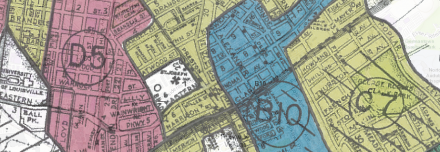
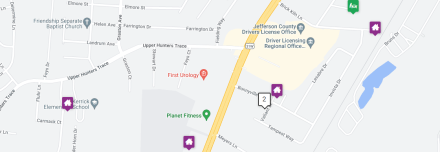
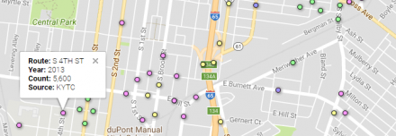
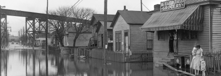
Additional Maps Redlining Louisville Investigate the effects of redining on housing, development, divestment, and lending patterens in Louisville, KY in the 1930s. Community Ministries Service Areas Enter an address and find in which Community Ministries Area you reside. NeighborMap The Center for Neighborhoods works with neighborhoods and partner organizations to educate and empower residents LMPD Crime Map Report of crimes committed and reported to Louisville Metro Police Department in Jefferson County. KIPDA Regional Traffic Counts Traffic counts provided by Kentucky Transportation Cabinet, Indiana Department of Transportation, Louisville Metro, and KIPDA. Lost Louisville Mapping photographs from the UofL Archives of buildings that once stood in the city. FEMA National Flood Hazard Layer Data from Flood Insurance Rate Maps (FIRMs) where available digitally. WAZE Traffic View Road Closure Map via WAZE and Louisville Metro Public Works. TRIMARC Traffic Real-time traffic information, with cameras, signage, and information on incidents.